

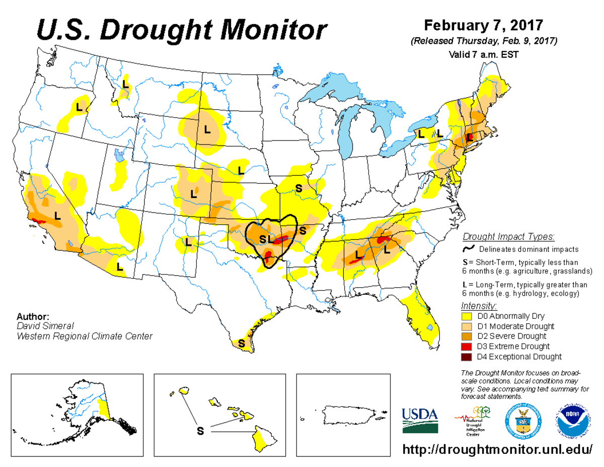
According to the February 7, 2017, U.S. Drought Monitor, moderate to exceptional drought covers 14.3% of the contiguous United States, a slight decrease from last week’s 14.6%. The worst drought categories (extreme to exceptional drought) also decreased slightly from 0.4% last week to 0.3%.
Pacific weather systems slammed into the West Coast this U.S. Drought Monitor week, bringing several inches of precipitation to the coastal states. But, a fairly flat “zonal” flow at the jet stream level kept the storm track confined to the northern states, with above-normal precipitation occurring only along the West Coast, in the Northern Rockies, and in the Northern Plains along the Canadian border. The rest of the contiguous United States was drier and warmer than normal.
The full U.S. Drought Monitor weekly update is available from Drought.gov.
In addition to Drought.gov, you can find further information on the current drought as well as on this week’s Drought Monitor update at the National Drought Mitigation Center.
The most recent U.S. Drought Outlook is available from NOAA’s Climate Prediction Center and the U.S. Department of Agriculture’s World Agriculture Outlook Board provides information about the drought’s influence on crops and livestock.
For additional drought information, follow #DroughtMonitor on Facebook and Twitter.


